

REIMAGINE WASHTENAW
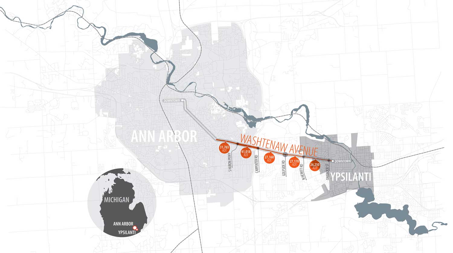
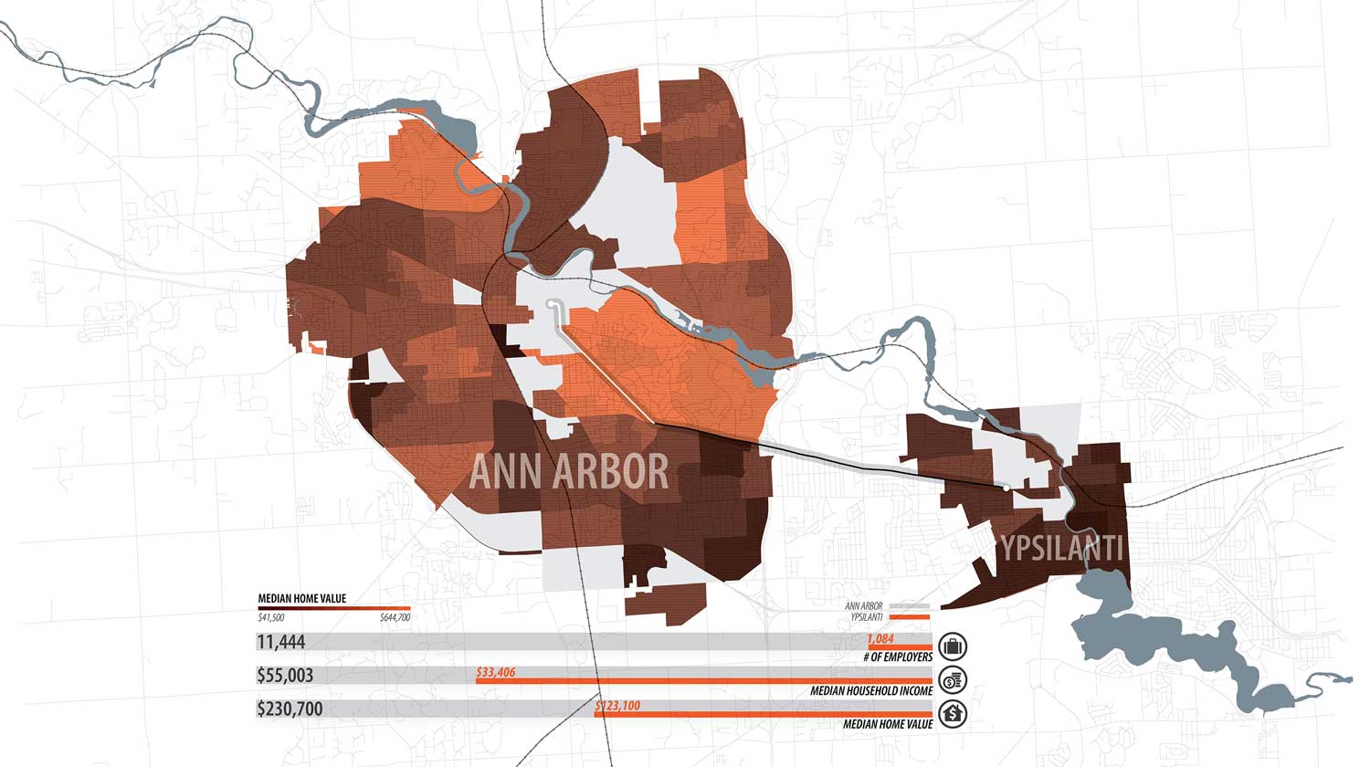
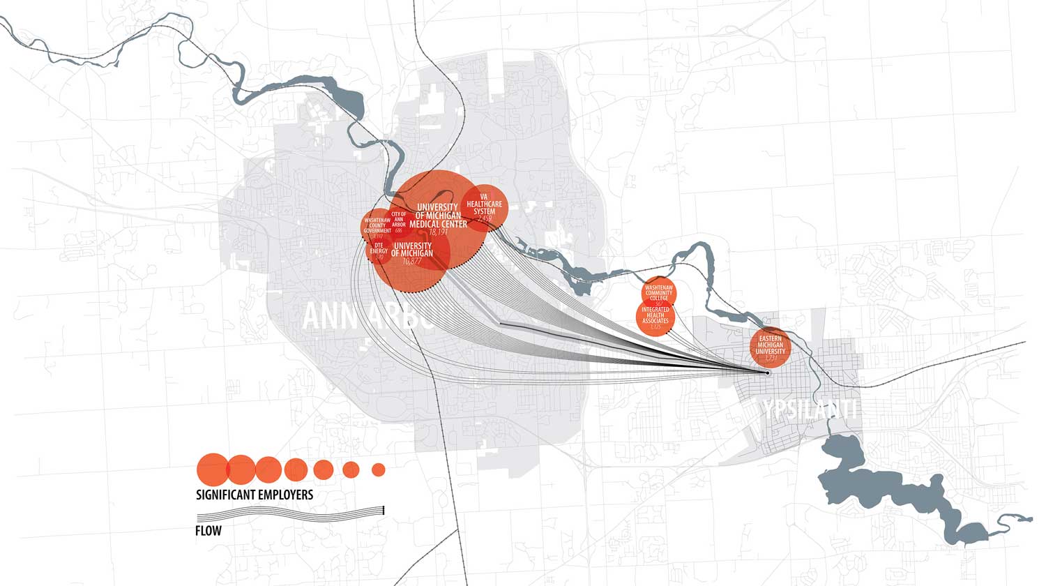
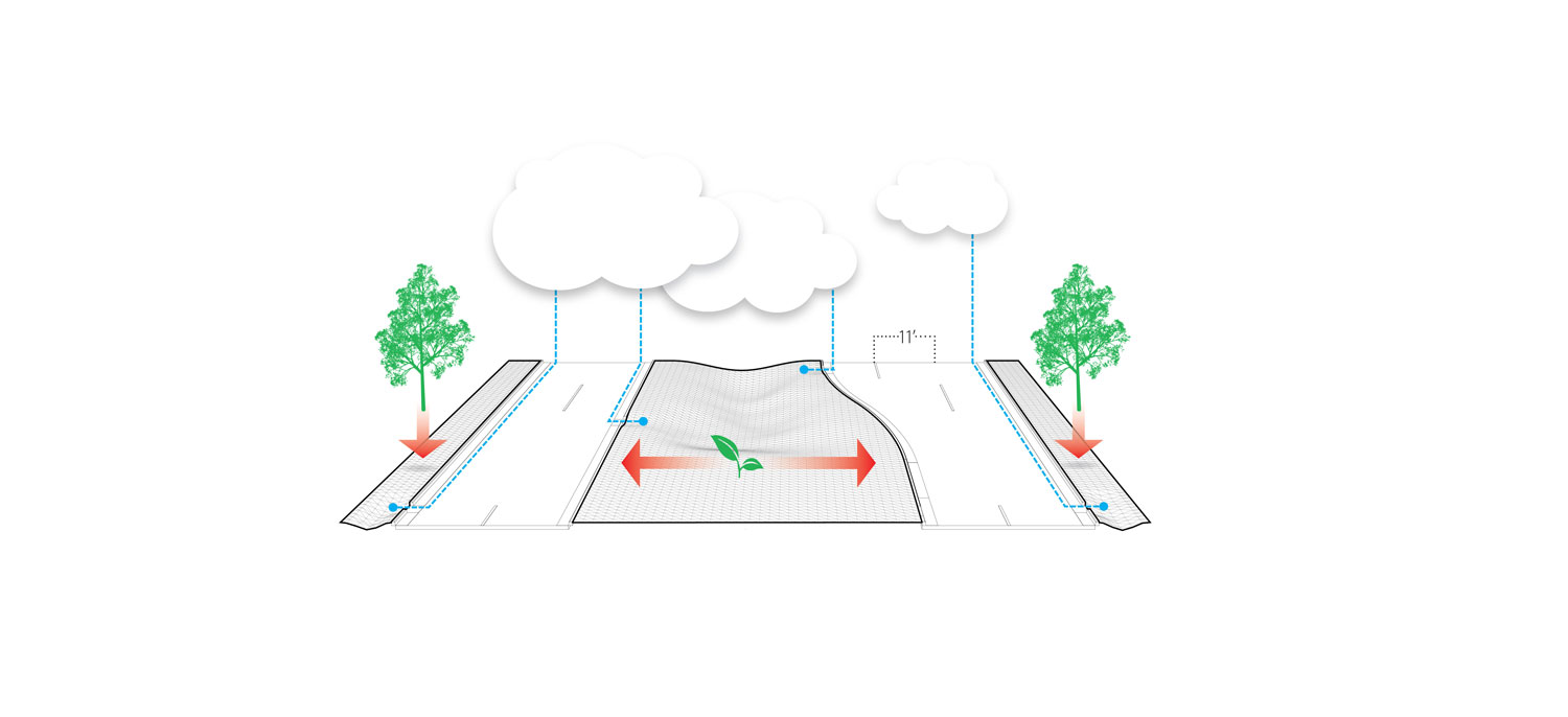
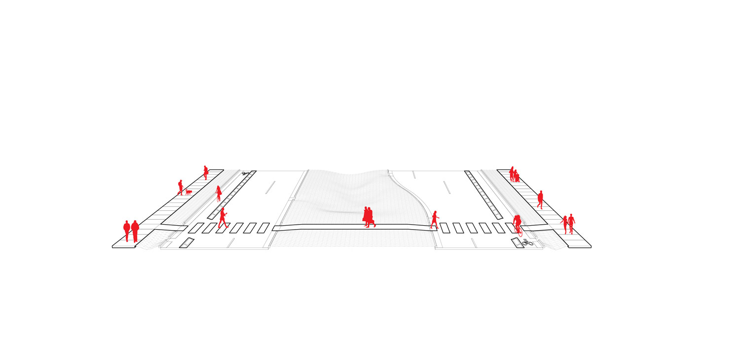
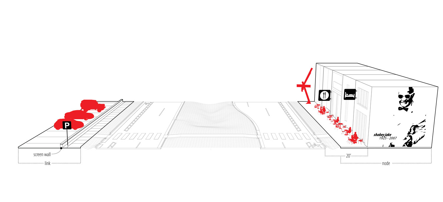
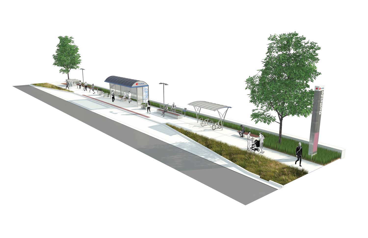
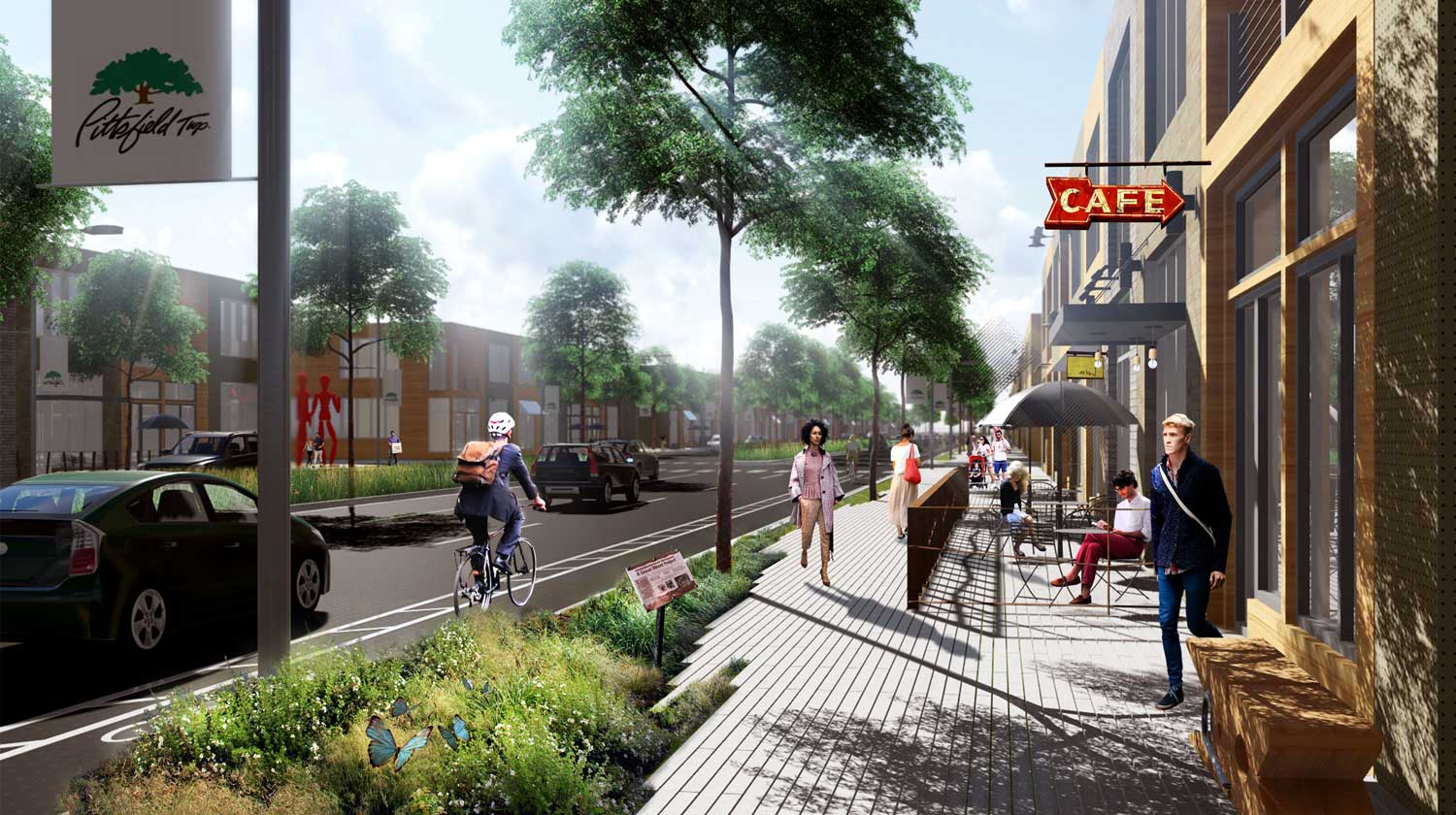
ReImagine Washtenaw is a planning project in southeastern Michigan focused on the redevelopment of a five-mile corridor that connects the municipalities of Ann Arbor and Ypsilanti. Substantial economic inequality exists between the two cities. As the primary transportation corridor between Ypsilanti residents and their Ann Arbor jobs, the ability to strengthen public transit and enhance non-motorized travel could help rectify the disparity between the two communities and increase the quality of life for all residents. Three road typologies were created for varying traffic conditions, and buffered bike lanes are included in each of them. Adjacent to the roadways are stormwater and pedestrian zones which vary in width dependent upon adjacent land uses. To allow for long-term realization of the plan, the corridor was ultimately drafted in AutoCAD and sent to the client to be used as a tool for acquiring R.O.W. necessary for implementation.
The project was recently recognized by the Michigan Chapter of ASLA with a Landscape Planning & Analysis Honor Award.
CLIENT: Washtenaw County (Michigan)
ROLE: Modeler, Renderer, Graphic Designer
SOFTWARE USED: ArcGIS, Illustrator, Photoshop, SketchUp, Vray, Lumion, AutoCAD